Nga Chang Supergroup Gr
Type Locality and Naming
Synonym: กลุม่หินสตูล
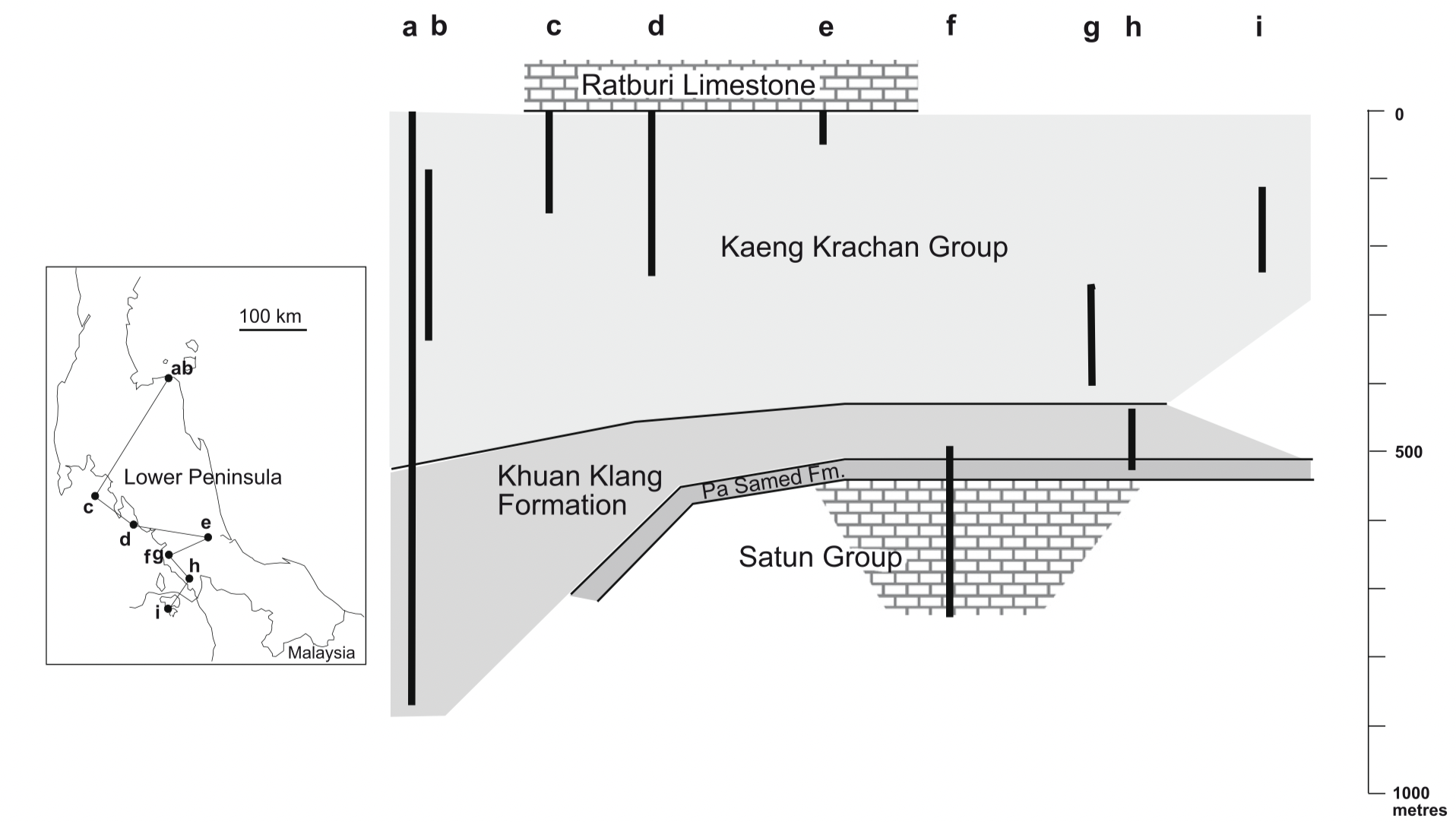
[Figure: Approximate correlation of measured sections within the Nga Chang Supergroup in Lower Peninsular Thailand. (a) Laem Thap in Nakhon Sithammarat Province (based on Lumjuan, 1993); (b) Laem Thap, same as ‘a’ (based on Chaodumrong et al., 2007); (c) Ko Phi Phi in Krabi Province (after Waterhouse, 1982); (d) Ko Muk in Trang Province (after Waterhouse, 1982); (e) Ban Kan Rae in Songkhla Province (after Fujikawa et al., 2005); (f) Thung Wa–Langu road in Satun Province (after Wongwanich et al., 2002); (g) and (h) Khuan Khi Ma and Khuan Sung in Satun Province (see Fig. 5; after DMR, 2004); (i) Pulau Ular, Langkawi, Malaysia (after Stauffer and Lee, 1986). The vertical relationship of one section to another is speculative and so therefore is the total thicknesses of the Kaeng Krachan Gr (Ridd. 2009).]
Lithology and Thickness
See lithology in each individual formation/group. (The Lower Ordovician-Lower Devonian Satun Gr, the Devonian Pa Samed Fm, the Carboniferous Khuan Klang Fm and the ?Carboniferous–Lower Permian Kaeng Krachan Gr).
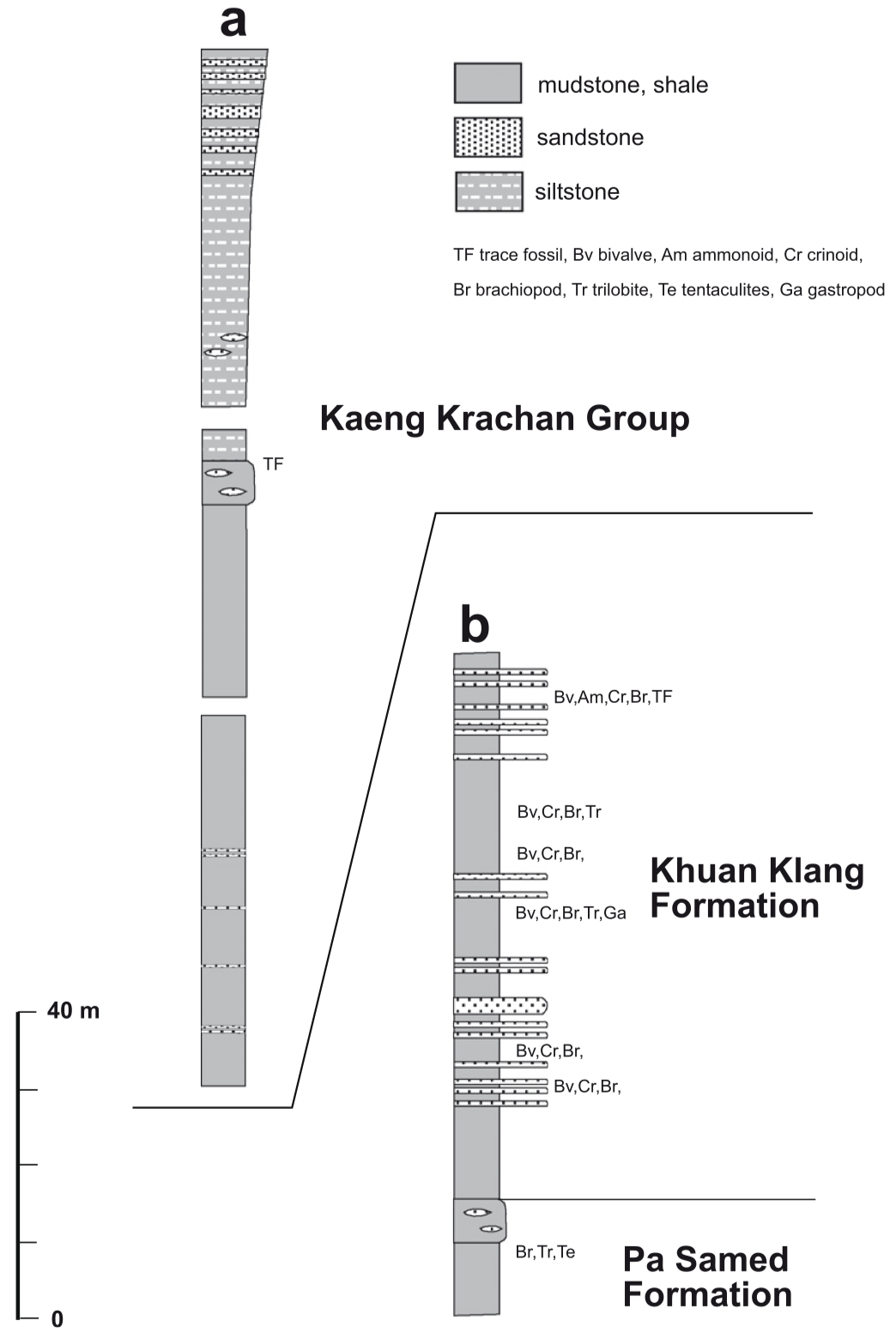
[Figure: Stratigraphic sections of parts of the Nga Chang Supergroup Gr, comprising the Devonian Pa Samed Fm, Carboniferous Khuan Klang Fm and the ?Carboniferous–Lower Permian Kaeng Krachan Gr in Satun Province. (a) Khuan Khi Ma, about 5 km WNW of Satun town; (b) Khuan Sung, about 3.5 km WSW of Satun town. Figure is From Ridd (2009), which was redrawn from DMR (2004).]
Relationships and Distribution
Lower contact
Overlies the Satun Gr (Kuan Tung Fm)
Upper contact
Overlain by the Chedi Conglomerate Fm (Triassic)
Regional extent
GeoJSON
Fossils
Age
Depositional setting
Additional Information
Katsumi Ueno & Thasinee Charoentitirat, 2011, Chapter5 Carboniferous and Permian in: Ridd, M.F., Barber, A.J., and Grow, M.J., editors, The Geology of Thailand, Geol. Soc. of London.
Lexicon of Stratigraphic Names of Thailand of 2013.

